

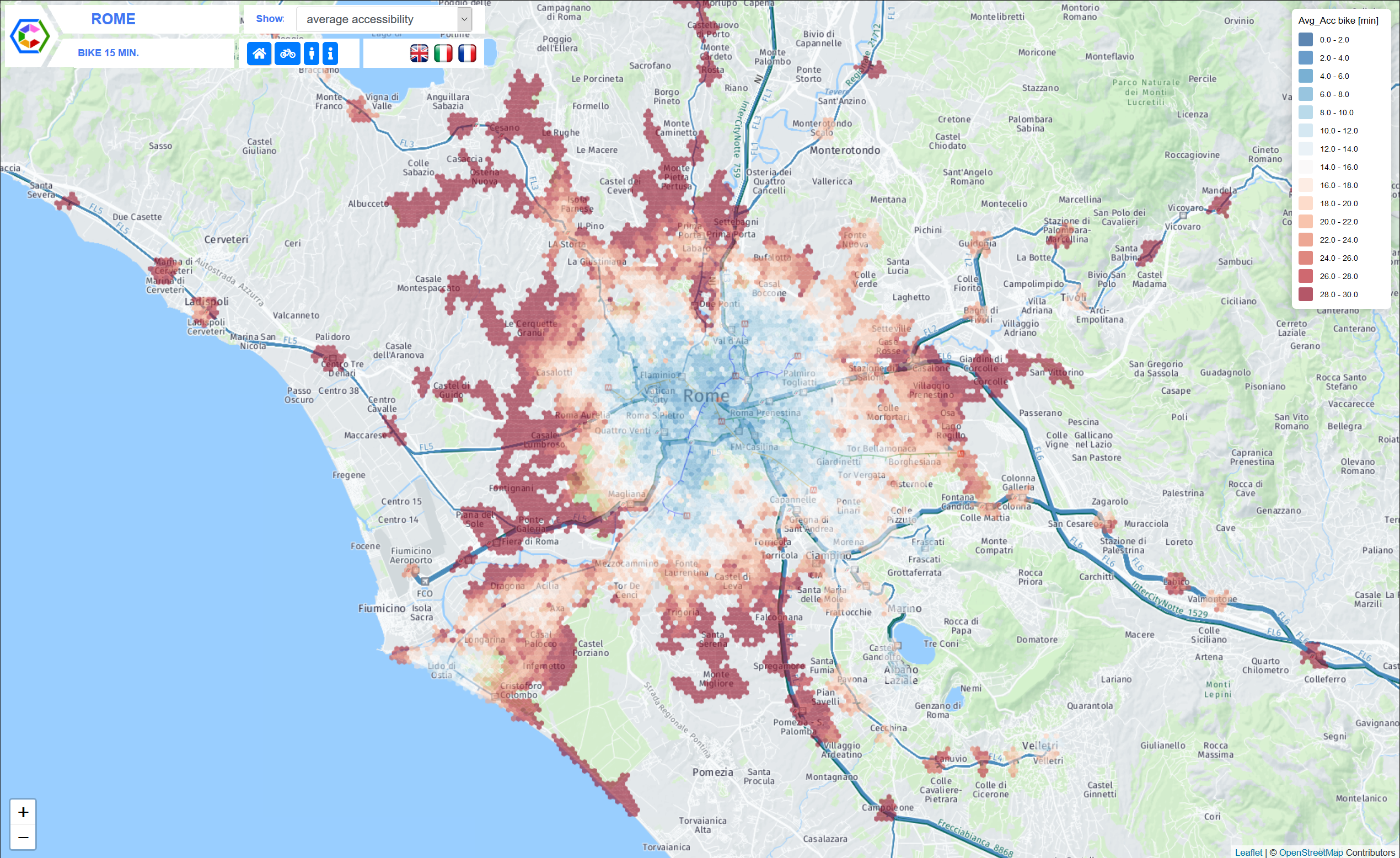
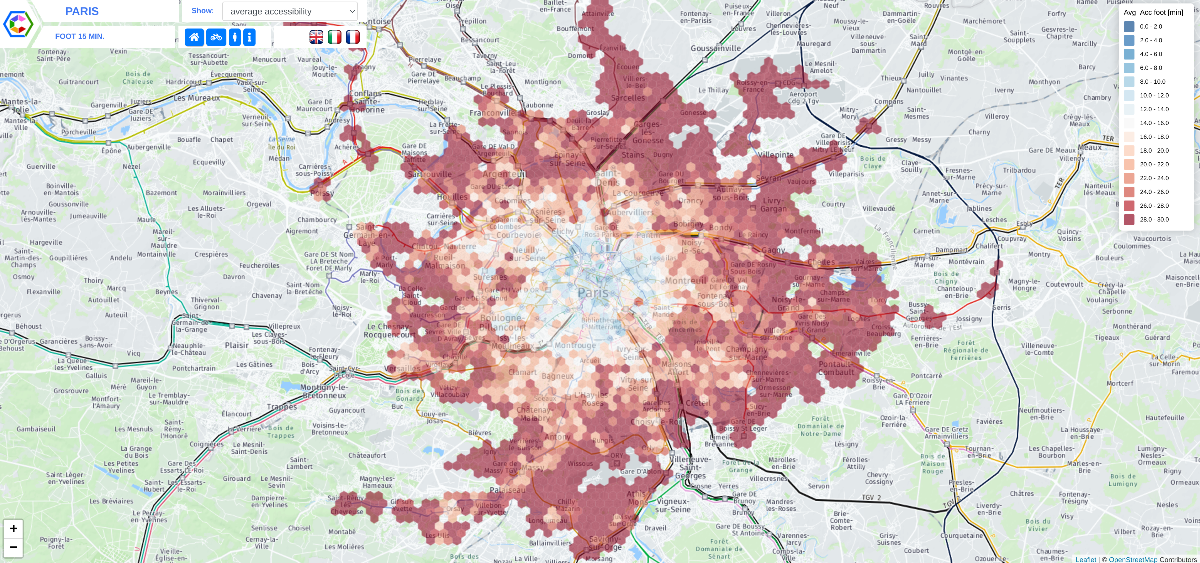
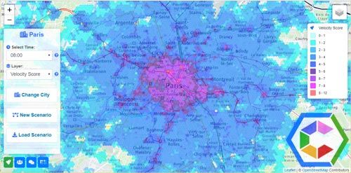
Timing Urban Spaces
CityChrone++ lets you explore in a very intuitive way the accessibility patterns allowed by public transportations systems in urban areas. The basic idea is to represent urban spaces in a way closer to people perception where distances are replaced by traveling times. CityChrone++ provides you with a powerful tool to assess the present status of urban accessibility and design and evaluate future scenarios. Start out by choosing a city on the map. Read more.
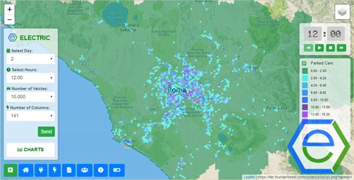
The future of Electric Mobility
The transition towards private electric mobility has been already started across the world, pushed forward by the need of independence from fossil fuels and of preserving good levels of air quality in urban centers, where vehicular traffic is mostly responsible for air and noise pollution. Read more.
Build Your Ideal City
KreyonCity is an immersive experience that allows users to play with urban scenarios, exploring the space of possible solutions to issues like employment, education and quality of life the more general sense. The backbone of KreyonCity is a data-driven mathematical model of urban indicators that can be tuned with heterogeneous data sources coming from different nations and different time frames. Read more.